curriculum
An immersive 10-week experience
Students start by exploring how satellites orbit, gather data, and communicate with Earth
🛰️ Weeks 1–3:
Satellites & Orbits
Learn how satellites transmit information across the electromagnetic spectrum.
Discover Newton’s and Kepler’s Laws in action to explain orbital motion, speed, and gravity
Case studies like GOES, NOAA, Meteor-M2, and Landsat
Hands-on projects and presentations bring theory into real-world context
📡 Weeks 4–6:
Radio Science & Signal Discovery
Construct the satellite dish & ground station.
Capture your first real satellite image directly from orbit
Learn about binary, hexadecimal, and ASCII encoding
Explore how data is transmitted, received, and corrected for errors
Decode live weather satellite signals
🌦️ Weeks 7-8:
Weather, Data & Satellite Imagery
Decode and visualize real data
Capture and explore images from NOAA satellites
Analyze temperature, wind, water vapor, and ozone
Create RGB composites and map projections
Use real-time geospatial data to study Earth systems
Week 9-10:
Capstone: Weather Tracking Investigation
Analyze global climate models (GCMs) and compare European vs. American storm predictions
Track hurricanes, storms, and environmental events with real data
Design a satellite mission with defined goals, orbits, data types, and sensors
Build a final research project that simulates data transmission and presents results
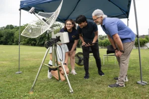